
Mount Spalding + Mount Evans
- Joanna Lee

- Jul 16, 2021
- 3 min read
Updated: May 12, 2023
July 16, 2021
Mount Spalding (13,842 feet) and Mount Evans (14,264 feet)
Route: Alltrails
5.2 miles; 2107 feet elevation gain
Total time: 2 hours 45 minutes
Note: You do need a reservation to enter Mount Evans road, if you are driving, but we were able to get one for this day a week ahead of time.
My dad's goal for this trip was to bike the Mount Evans road to the summit. This bike ride is 56 miles with 7,000 feet of elevation gain and goes from Idaho Springs to the summit of Mount Evans. My mom and I decided to hike Mount Evans to meet him at the summit. If anyone wonders where I get my crazy side from, this should explain it haha!
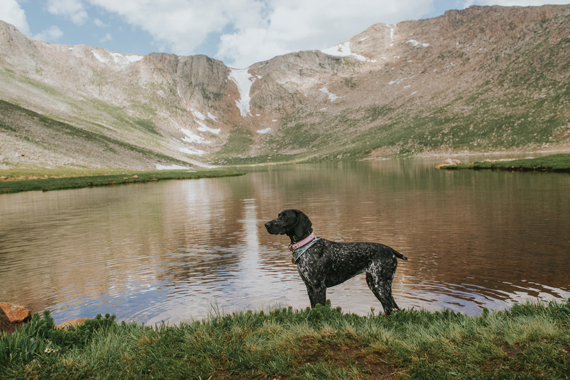
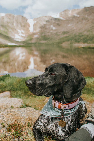
We left our house around 6am and dropped my dad off on the way to Summit Lake where we would park. We started our hike at 7:20am. I will start by saying, while this route is class 2 it is not for the faint of heart. It has a considerable amount of scrambling and some exposure in the first mile and last mile of the ascent. It was much more technical than I remember from climbing it in 2019 - it is not an easy 14er. It is also hard with a dog too. I wouldn't recommend it unless you are confident in your dogs skills and know their comfort level with steep cliffs/drop offs. This is the most challenging climb Nyx has done and she impressed me thoroughly but definitely not a great route for dogs!
The first mile has a defined path but also includes some scrambling up rocks with a few sharp drop offs. Around 1.3 miles you reach the summit of Mount Spalding and can see your path to the top of Mount Evans, which looks very far away at this point. You then descend slightly and cross an open tundra before ascending again. You get a little break from scrambling and elevation gain here for about 0.7 miles. Around the 2 mile mark you head around the back side of Mount Evans, from here it is rock scrambling the rest of the way with a steep drop off to your right! We reached the summit in 2 hours, about 2.8 miles. We spent about an hour on the summit (I stopped my watch) between meeting my dad in the parking lot for photos and enjoying a snack on the actual summit. There were a few other groups on the summit that hiked it but not many, most people drove to the summit. There were plenty of mountain goats hanging out on the summit too!
From here we deviated from the alltrails and 14ers route. They both recommend an out and back, however the descent route on alltrails used to be down the face on a scree slope (see picture below). This is the route I did last time so I decided to see if it was still there today because honestly I did not want to descend the same way with all that scrambling. We met up with another group who were considering the same route down. We checked it out and found that there is a path all the way down from the parking lot to the road. It looks like a scree slope down the face of the mountain but it was honestly a pretty clear path with only a few loose spots. There was plenty of mountain goats on this route too!! It was definitely a more enjoyable route down and only took 40 minutes to get back to summit lake.
Overall, I really enjoyed the bit of scrambling this hike had to offer. It was the perfect weather with no wind and clear skies all morning which made it more enjoyable. Just keep in mind, this is not an easy 14er.


Comments